The integration of drone technology into site mapping before and after demolition offers a significant advancement in project management. Drones facilitate high-resolution imaging and detailed 3D modeling, which enhances pre-demolition assessments. During demolition, they provide real-time monitoring, ensuring adherence to safety protocols. Post-demolition, aerial documentation allows for precise evaluations of site conditions. This methodology not only improves efficiency but also raises questions about future applications in the construction and demolition sectors.
Benefits of Drone Technology in Site Mapping
The integration of drone technology in site mapping offers numerous advantages that enhance the efficiency and accuracy of data collection processes. Drones provide aerial accuracy that surpasses traditional surveying methods, capturing high-resolution images and precise measurements from multiple angles. This capability allows for the creation of detailed topographical maps and 3D models, which are invaluable for project planning and analysis.
Moreover, the use of drones greatly improves cost efficiency by reducing the time and labor required for ground-based surveys. Traditional methods often involve extensive manpower and lengthy timelines, whereas drone operations can be completed in a fraction of the time.
Additionally, the data collected can be processed quickly using advanced software, further streamlining workflows. As a result, stakeholders benefit from timely insights and enhanced decision-making, positioning drone technology as a transformative tool in the field of site mapping.
Pre-Demolition Site Analysis With Drones
Although traditional site analysis methods have been effective, utilizing drones for pre-demolition site analysis enhances the accuracy and efficiency of data collection. Drones equipped with high-resolution cameras conduct aerial imagery analysis, capturing detailed visual data that traditional ground surveys may overlook. This aerial perspective allows for extensive evaluations of structural conditions and site layouts.
Incorporating pre-demolition checklists into the drone survey process guarantees that critical elements, such as hazardous materials, structural integrity, and surrounding environments, are systematically assessed. The data collected can be processed into 3D models, enabling stakeholders to visualize potential challenges and inform decision-making.
Furthermore, the expedited data acquisition minimizes project delays and reduces labor costs. By leveraging drone technology, construction teams can achieve a more thorough pre-demolition analysis, ultimately leading to safer and more efficient demolition practices.
Real-time Monitoring During Demolition
Utilizing drones for real-time monitoring during demolition enhances safety and operational efficiency on construction sites.
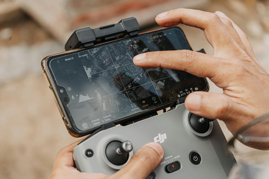
These unmanned aerial vehicles provide extensive aerial surveillance, allowing project managers to assess ongoing activities and potential hazards from a unique vantage point. By capturing real-time data, drones facilitate immediate decision-making, thereby minimizing risks associated with traditional monitoring methods.
The integration of high-resolution cameras and sensors enables the detection of structural weaknesses or unexpected issues that may arise during demolition. This proactive approach allows teams to adjust their strategies promptly, ensuring compliance with safety regulations and reducing the likelihood of accidents.
In addition, drones can monitor equipment usage and personnel movements, optimizing workflow and resource allocation.
Post-Demolition Assessment and Documentation
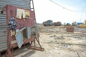
Following the completion of demolition, a thorough assessment and documentation process is essential to guarantee that the site is adequately evaluated and prepared for subsequent construction phases. This post-demolition evaluation incorporates aerial imagery to provide a detailed visual record of the site conditions. Drones facilitate this process by capturing high-resolution images that aid in identifying any remaining debris and structural concerns.
| Evaluation Aspect | Description |
|---|---|
| Site Integrity | Assessment of ground stability and safety |
| Debris Clearance | Documentation of remaining materials |
| Environmental Impact | Evaluation of potential pollutants |
| Boundary Verification | Confirmation of property lines and easements |
| Regulatory Compliance | Ensuring adherence to local demolition laws |
Future Trends in Drone Use for Construction and Demolition
As advancements in technology continue to reshape the construction and demolition industries, the integration of drones is poised to greatly enhance operational efficiency and safety.
Future trends indicate an increased reliance on autonomous drones, which can perform complex tasks such as site inspections, real-time monitoring, and data collection with minimal human intervention. These drones are expected to leverage advanced artificial intelligence and machine learning algorithms to improve accuracy and decision-making processes on job sites.
However, the widespread adoption of drones faces regulatory challenges that must be addressed to fully realize their potential. Compliance with airspace regulations, safety standards, and privacy concerns will necessitate collaboration between industry stakeholders and regulatory bodies.
As these challenges are navigated, the construction and demolition sectors stand to benefit from enhanced productivity, reduced costs, and improved safety outcomes, making drone technology an indispensable tool in future operations.
Frequently Asked Questions
What Types of Drones Are Best for Site Mapping?
When considering the best types of drones for site mapping, several factors contribute to survey accuracy.
Fixed-wing drones excel in covering large areas quickly, providing high-resolution imagery, while multi-rotor drones offer superior maneuverability and detailed data capture over smaller sites.
Additionally, hybrid drones combine the benefits of both types, enabling efficient long-range mapping with the ability to hover for intricate details.
Ultimately, the choice depends on specific project requirements and desired precision levels.
How Much Does Drone Mapping Technology Cost?
The cost of drone mapping technology varies considerably based on several cost factors, including the type of drone, camera quality, and software used for data processing.
A technology comparison reveals that entry-level drones can range from $1,000 to $3,000, while professional-grade models may exceed $10,000.
Additionally, ongoing expenses such as software licenses, training, and maintenance must be considered, ultimately influencing the total investment required for effective drone mapping solutions.
Are There Legal Restrictions on Drone Usage for Mapping?
Maneuvering the skies with drones requires careful attention to legal compliance, as regulations can vary greatly by jurisdiction.
While drone technology offers innovative mapping capabilities, privacy concerns loom large, necessitating adherence to local laws governing airspace and data collection.
Operators must guarantee they are not infringing on individual privacy rights while conducting their mapping activities.
Consequently, understanding the legal landscape is vital for successful and responsible drone usage in mapping endeavors.
How Long Does a Drone Mapping Project Typically Take?
The duration of a drone mapping project typically varies, influenced by factors such as the project size and complexity.
Effective project planning is essential to optimize drone efficiency, often allowing for a streamlined process.
Generally, small to medium-sized areas can be mapped within a few hours, while larger sites may require several days.
Can Drones Be Used in Adverse Weather Conditions?
As dark clouds loom and raindrops dance against the ground, the performance of drones can be considerably impacted by adverse weather conditions.
Strong winds, heavy rain, and low visibility hinder flight stability and data accuracy, often rendering mapping ineffective. Technological advancements have improved resilience, but operators must consider safety and operational integrity.
In challenging environments, the precision of drone performance diminishes, necessitating careful assessment of weather conditions before deployment.